
GeoMAC (thumbnail)
Description:
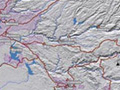
The USGS has developed an Internet-based mapping tool referred to as Geospatial Multi-Agency Coordination (GeoMAC) to support collaborative decision-making by fire coordination centers. (Image courtesy of the USGS.)
file
9 kB
GeoMAC (thumbnail)
Alt text:
GeoMAC fire mapping tool.
Caption:
The USGS has developed an Internet-based mapping tool referred to as Geospatial Multi-Agency Coordination (GeoMAC) to support collaborative decision-making by fire coordination centers. (Image courtesy of the USGS.)
Course Info
Instructor
Departments
As Taught In
Spring
2006
Level
Topics
Learning Resource Types
assignment_turned_in
Written Assignments with Examples


