21l-501s13.jpg
Description:
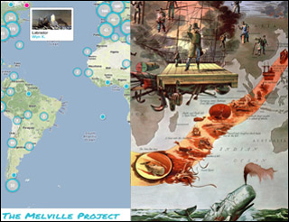
Students use digital tools like this virtual map of Moby Dick to plot key points to aid their literary analysis. The map is shown here alongside a printed illustration of the Pequod’s voyage. © Google maps data on left and © Harris-Seybold map on right. All rights reserved. This content is excluded from our Creative Commons license. For more information, see http://ocw.mit.edu/fairuse.
file
58 kB
21l-501s13.jpg
Alt text:
A map of the world with the left half showing a modern digital map of the Americas with points plotted by students and the right side showing an old literary map of the voyage of the Pequod.
Caption:
Students use the digital mapping tool Locast to plot key points to aid their literary analysis of Moby-Dick. The virtual map is shown here alongside a printed illustration of the Pequod’s voyage. (© Google maps data on left and © Harris-Seybold map on right. All rights reserved. This content is excluded from our Creative Commons license. For more information, see http://ocw.mit.edu/fairuse.)
Credit:
© Google maps data on left and © Harris-Seybold map on right. All rights reserved. This content is excluded from our Creative Commons license. For more information, see http://ocw.mit.edu/fairuse.

Course Info
Learning Resource Types
assignment
Activity Assignments
assignment
Presentation Assignments
assignment_turned_in
Written Assignments with Examples
Instructor Insights


