
16-485f20-th.jpg
file
4 kB
16-485f20-th.jpg
Alt text:
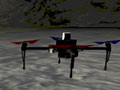
A drone flying over a terrain and a few other vehicles on that terrain as well
Caption:
Application of VNAV in DARPA’s Subterranean Challenge to map, navigate, and search complex underground environments, including human-made tunnels, urban underground, and natural cave systems. (Image courtesy of DARPA / public domain.)
Course Info
Instructors
Departments
As Taught In
Fall
2020
Level
Topics
Learning Resource Types
assignment
Programming Assignments
notes
Lecture Notes


